
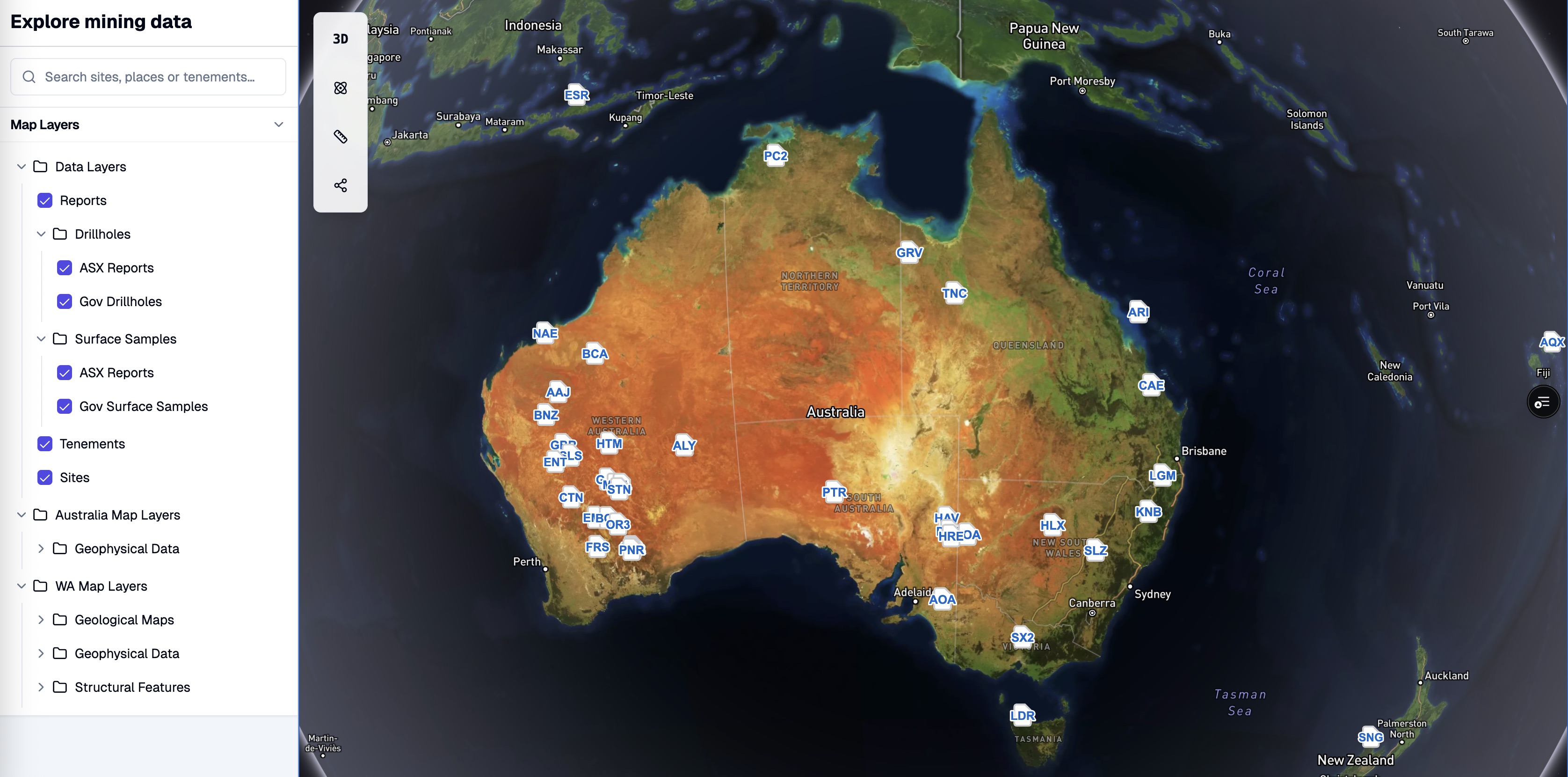
Australia Wide Database
CaneToad brings together a broad Australian geological database that combines tenements, extracted announcement data, and government sources in one environment. This gives users a more complete national view of exploration activity without needing to stitch together multiple datasets on their own.
Because the database is updated daily, it supports both regional scanning and targeted project work with fresher context. Investors and technical teams can move from fragmented data gathering to faster country-scale discovery, comparison, and diligence.
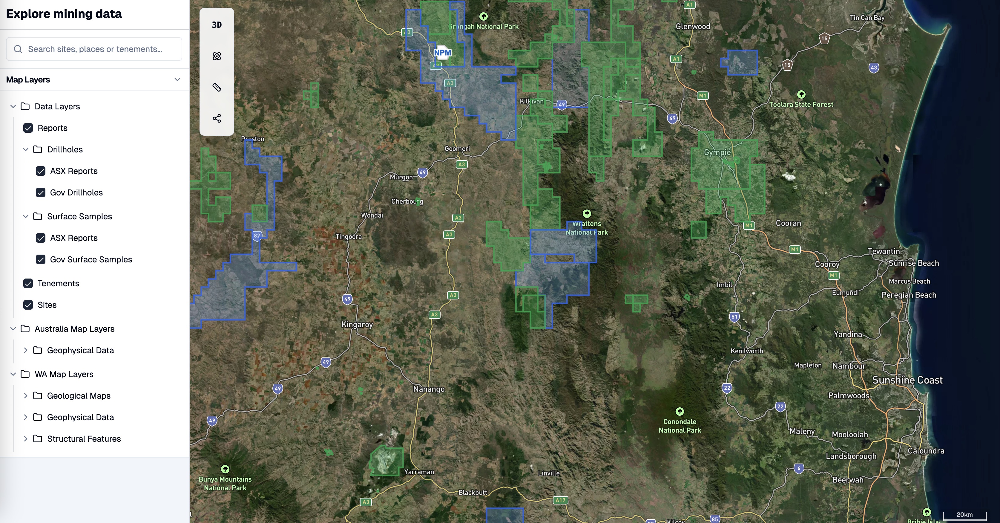
Explore Mode
Explore Mode gives users a map-first way to investigate regions with immediate geological context. Drillholes, surface samples, announcements, sites, and tenements can all be viewed together, making it easier to move from a broad regional search to a specific target area.
This helps users narrow opportunity faster because the relevant data is visible in one place rather than scattered across separate tools. Whether scanning for new ideas or validating an existing thesis, Explore Mode supports quicker spatial reasoning and more efficient early-stage research.
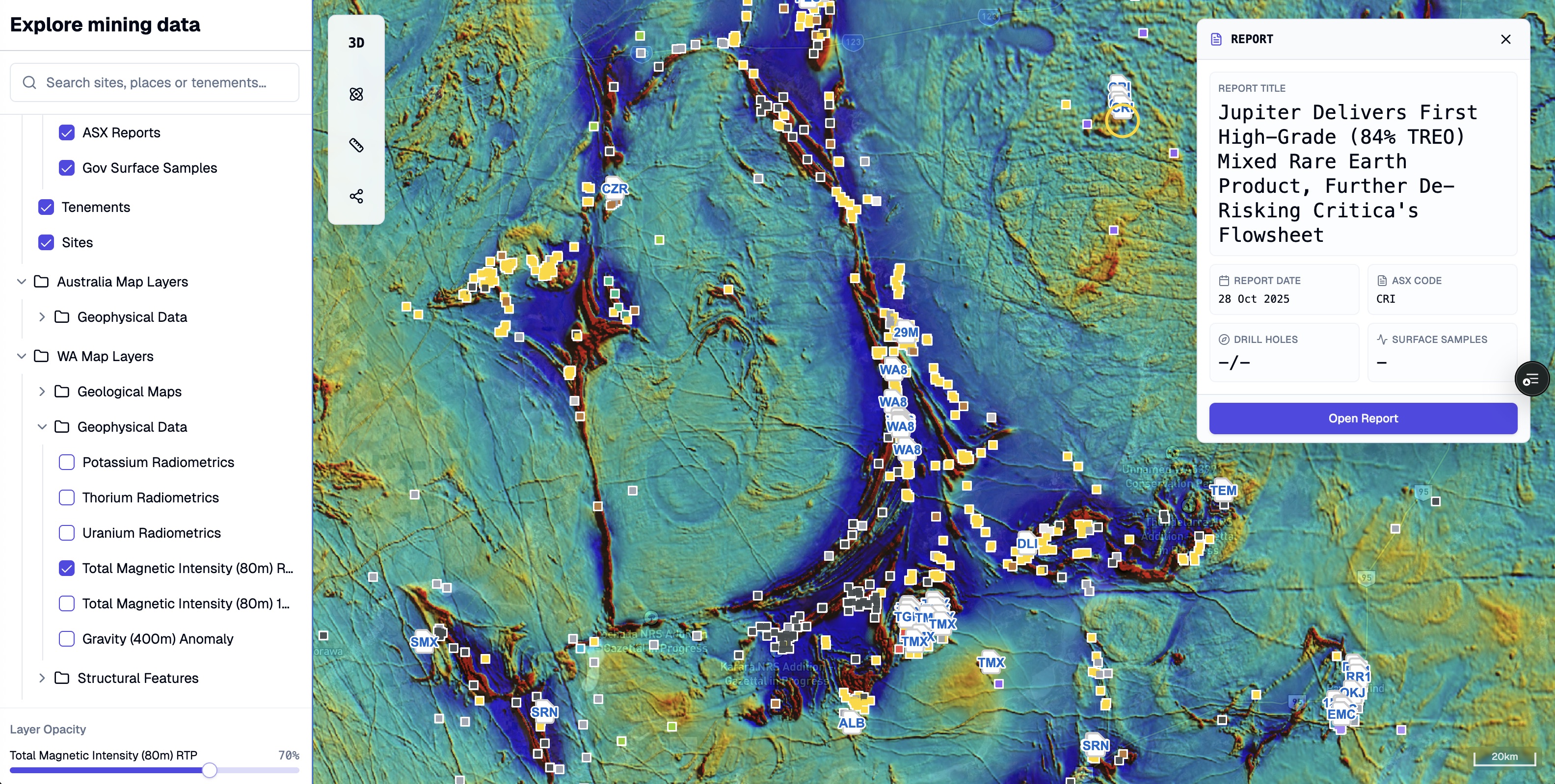
Geophysical Magnetics
CaneToad overlays geophysical layers such as magnetics, gravity, and radiometrics directly onto the map, helping users interpret drilling in the context of the broader geological system. Instead of focusing only on isolated assays, teams can see the structural architecture that may be controlling mineralisation.
This adds an important regional lens to exploration research by making faults, shears, intrusive trends, and analogue signatures easier to spot. With geophysics and drilling in the same view, users can build stronger hypotheses, compare projects more effectively, and identify opportunities that are not obvious from announcement tables alone.
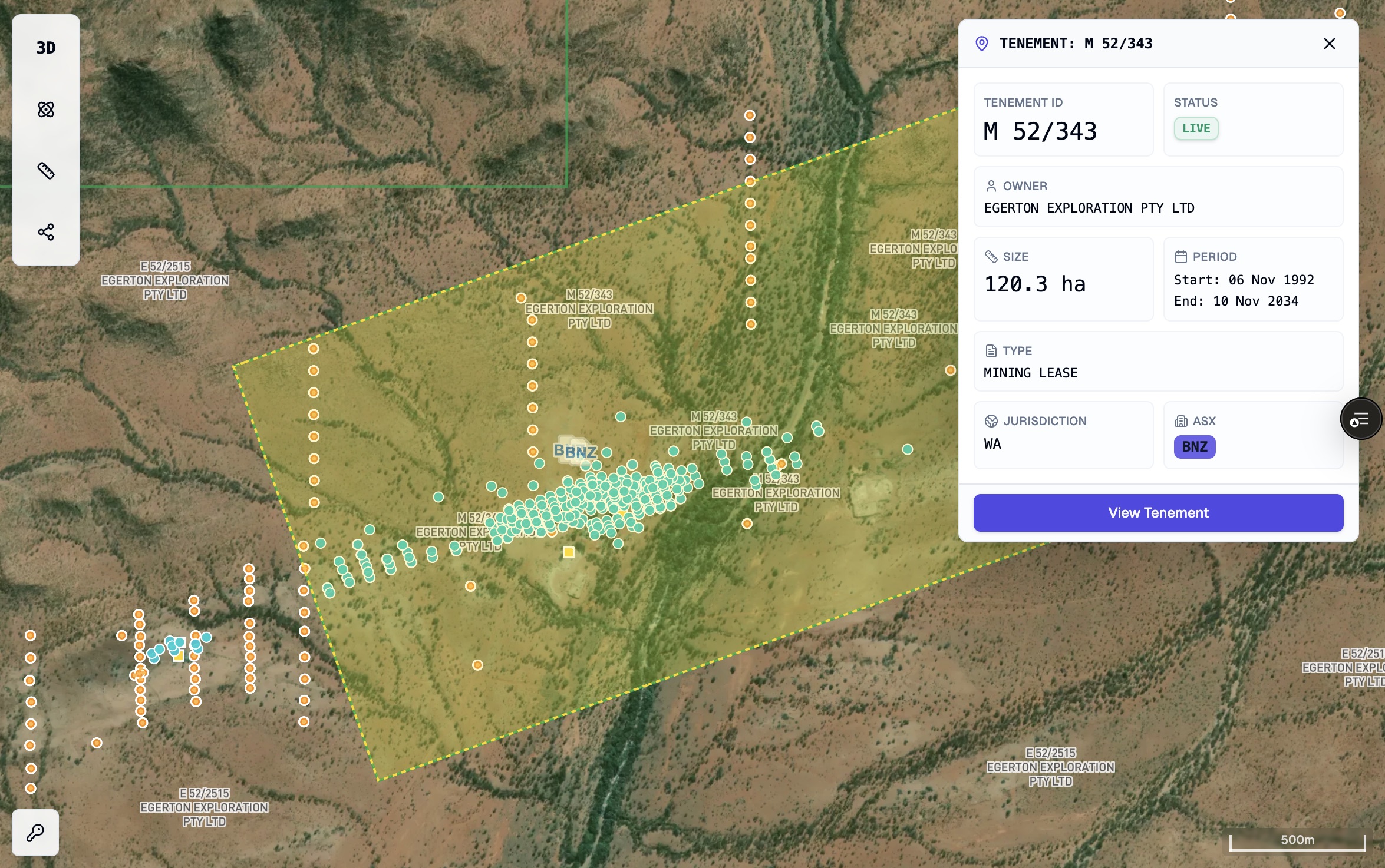
Tenement Mapping
CaneToad maps tenure boundaries in direct relationship to drilling, infrastructure, and regional geology, helping users assess strategic ground in context rather than in isolation. This makes it easier to identify vacant or high-potential areas, monitor boundary trends, and understand where exploration momentum may be building.
By linking land position to real geological signals, CaneToad turns tenure review into a faster and more practical prospecting workflow. Users can shortlist opportunities with better evidence, reduce time spent across disconnected portals, and act earlier when attractive ground becomes available.
Tenement Tracking
CaneToad tracks tenement changes daily and connects tenure data to the surrounding geological context. Users can see ownership, linked ASX entities, nearby drilling, surface samples, and announcements together, which makes it easier to understand how ground position relates to exploration activity.
This is especially useful for spotting dropped ground, monitoring competitor movement, and assessing strategic land positions without relying on manual spreadsheet tracking. By combining tenure updates with live project context, CaneToad helps users make faster and better-informed land decisions.
"Most map tools make you do the hard yards yourself. This puts the tenure, geology, and action on the same surface so you can hunt properly."
Corporate Development Manager · Brisbane
Search regions faster with geology, tenure, and activity in one map.
CaneToad gives users a cleaner regional workflow for target generation, competitor tracking, and geological research.