Speed to Insight
The investor who sees structure first wins. The one reading PDFs at 9am loses.
From PDF to 3D in 20 minutes — automatically
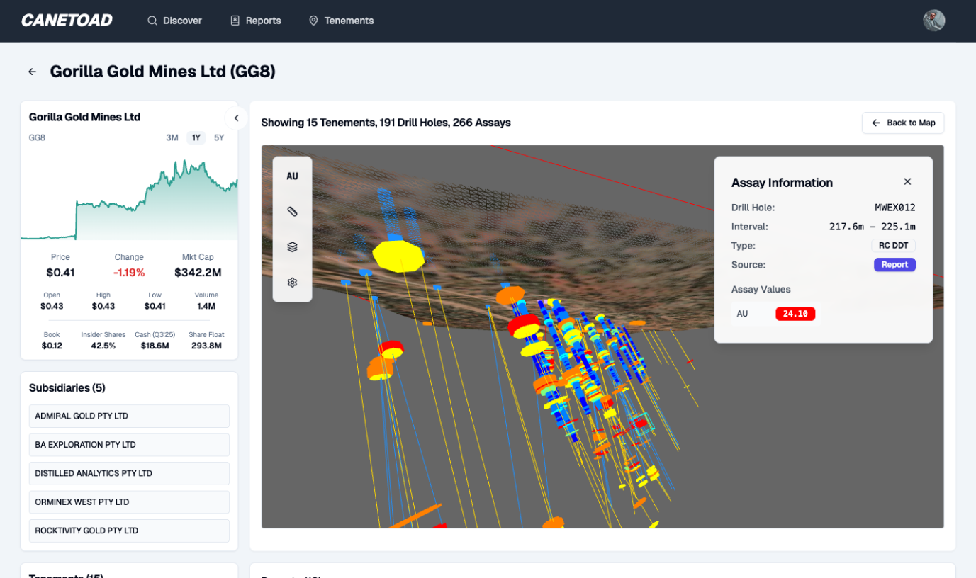
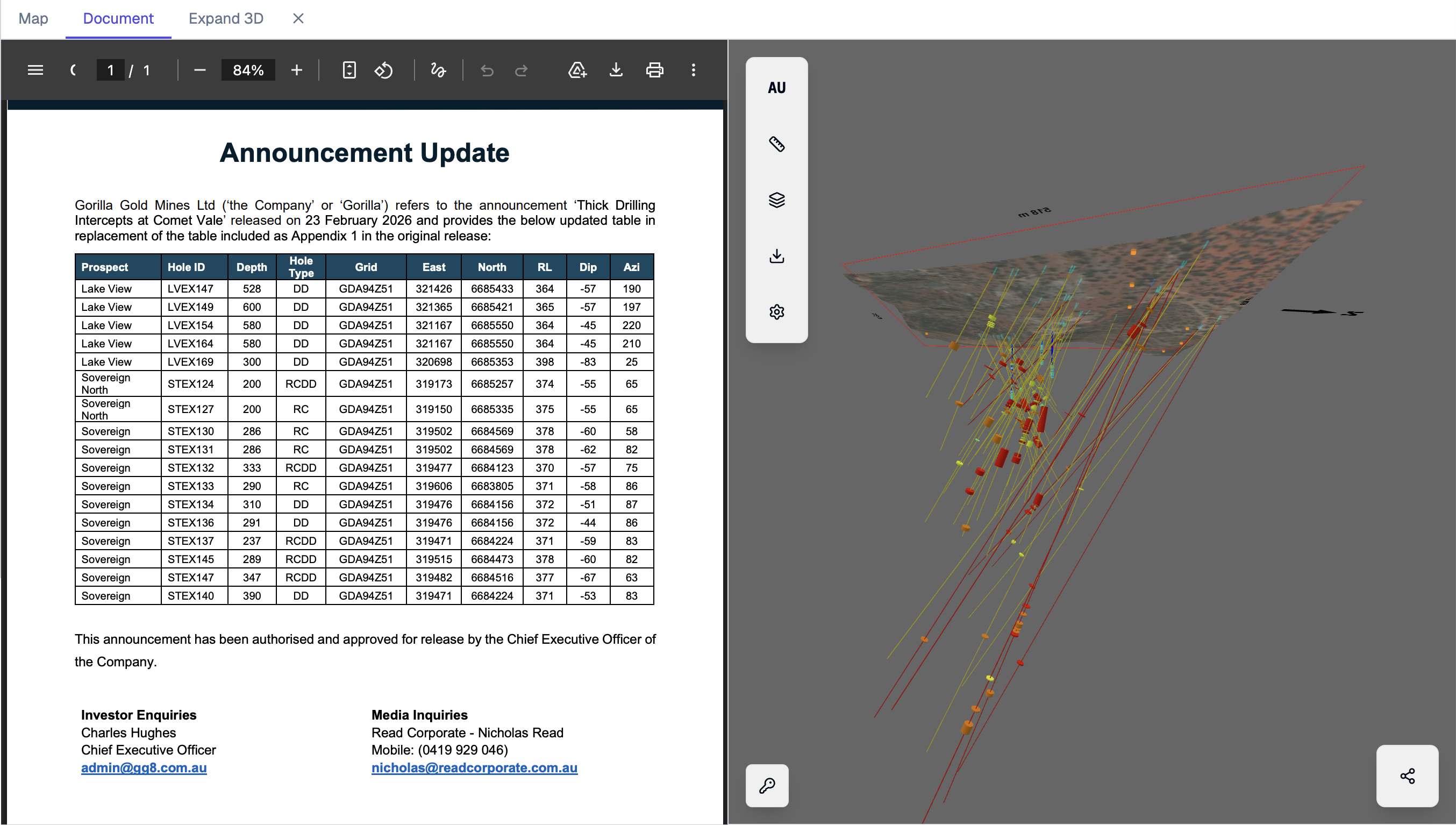
Every hour spent manually extracting coordinates from PDF tables is an hour someone with better tools is already acting on the same information. Canetoad's ingestion pipeline normalises drill tables, transforms coordinates, and plots results into the existing spatial model within approximately 20 minutes of ASX release. No manual data entry. No Excel. No coordinate conversion headaches.
Act on structure while narrative is still forming
Spatial truth first.
Geology exists in 3D, but market participants are asked to trust 2D snippets and promotional language. /n
Precise verification
Measure strike, plunge, and continuity to test whether intercepts are coherent or random scatter.
Pull-model diligence
Stop consuming curated narratives. Pull raw context and challenge every claim directly.
Never re-extract the same data twice
Canetoad's persistent memory means every ingested announcement enriches a long-lived spatial database. That hole from 18 months ago that barely missed? It's still there, contextualising today's results. No re-downloading old PDFs, no re-plotting old coordinates, no lost context. The database compounds over time.
"I used to spend mornings manually plotting PDF coordinates." Now 20 minutes after release, the model is updated and actionable.
Private Resource Investor · Subiaco
Get actionable insights today.
Start using Canetoad today to get actionable insights from ASX mining announcements. Get the edge on the market.